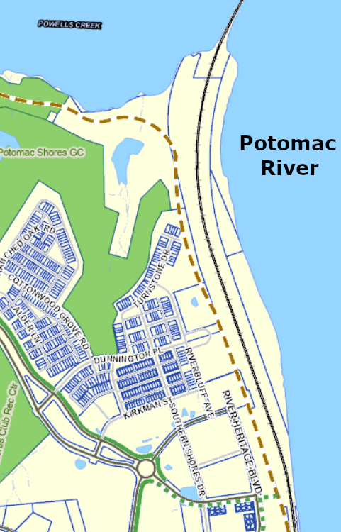
The exact route of the PHNST depends upon arrangements negotiated between the Potomac Shores developer and Prince William County. There is a proffer for the PHNST to pass through Potomac Shores, but the specific alignment has been left undetermined until the county accepts detailed plans for different phases of development.
Phase 3 of the developer’s Natural Trails Plan has now been accepted by the county. That plan identifies the PHNST route between Powells Creek and the Virginia Railway Express (VRE) station at Potomac Shores.
From where the Powells Creek Crossing reaches the southern bank of Powell’s Creek, the trail will be located on a 10′ wide easement. The PHNST will first go east, parallel to the creek. Once it nears the CSX railroad tracks, the trail will turn south and parallel the Potomac River and the CSX tracks, using a flat bench on the steep hillside.
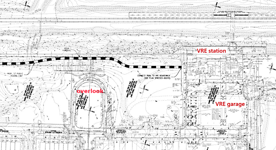
Hikers/bikers will pass below the existing Potomac Shore overlook that was built north of the Virginia Railway Express (VRE) station. When the trail reaches the commercial development surrounding the VRE station, there will be a good view of the Potomac River.
There will be no direct connection to the PHNST downhill from the overlook; the hill is too steep. The Department of Parks and Recreation (DPR) may negotiate for a future link from the VRE station, as development plans around it are finalized.
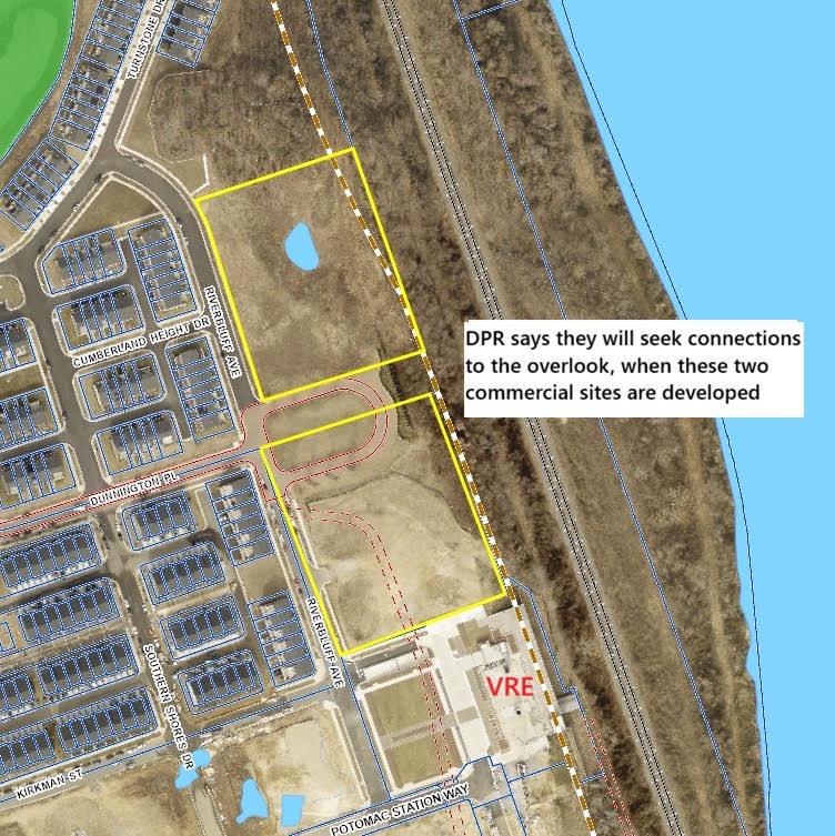
Unlike at the VRE Rippon Station, there will be no need to use the elevator at the Potomac Shores VRE station to continue south to Cockpit Point Park.
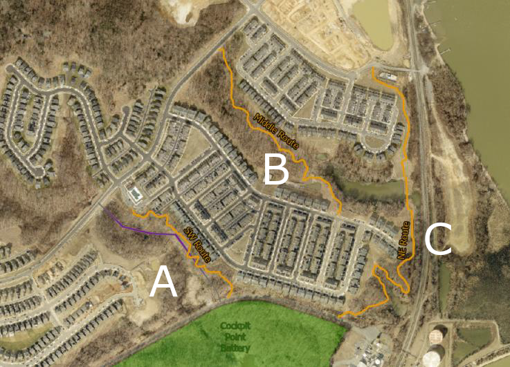
Going south of the VRE station, there are three options – each with its own challenges.
As shown below, Route “A” would intercept Cockpit Point Road at a location where no trailhead parking could be constructed. The Virginia Department of Transportation may also have concerns regarding safety, since there is limited visibility where bikers/pedestrians would cross the highway.
Route “B” would follow a stream channel and have to find space to skirt the fence surrounding a stormwater pond.
Route “C” would also have to squeeze around a stormwater pond, or require a bridge across the stream at its outlet. That route would be closest to the Potomac River and provide the best connection to a future trailhead parking lot, but also would be the longest – and potentially the most expensive to construct. The county may have to convince the developer to build what might be the most expensive option, in order to satisfy the proffer.
The final route will be determined when the county approves the detailed development plan for the property south of the VRE station.